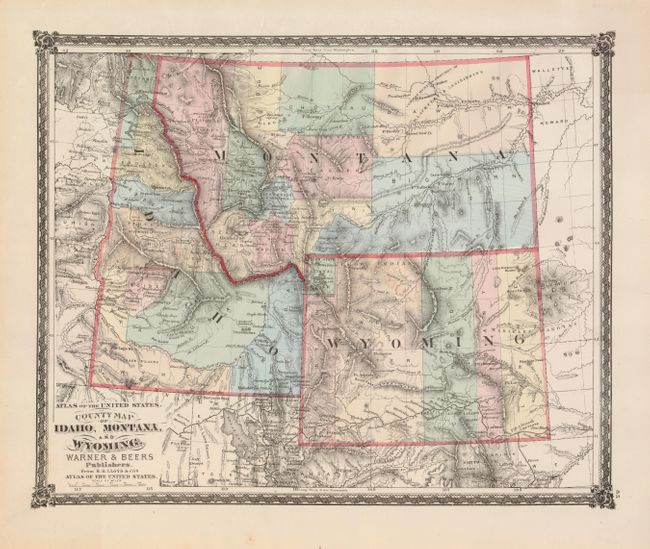
Subject: Northwestern United States
Period: 1875 (published)
Publication: Atlas of the United States
Color: Hand Color
Size:
16 x 13 inches
40.6 x 33 cm
This map includes up-to-date information on the mountains and rivers, but it is out-dated in Wyoming, east of Yellowstone National Park. The Union Pacific Railroad is prominently shown in southern Wyoming with all the stations located along its route. A proposed railway through Montana includes a spur down the Gallatin Valley into Yellowstone Park. There are several gold mining regions located in Idaho. The Common Hunting Grounds of Blackfeet & Assiniboins are located in northeastern Montana where a prominent string of forts and trading posts follow the Missouri and Milk Rivers. Published by Warner & Beers.
References: Blevins #387.
Condition: A+