Subject: Western United States
Period: 1876 (dated)
Publication:
Color: Printed Color
Size:
22.3 x 16 inches
56.6 x 40.6 cm
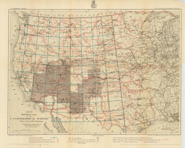
Both maps are important historical documents attesting to the effort and skill of Wheeler and his surveyors. The maps show the progress of surveying in the 1870's. Both maps cover the same area on the same scale. Lieutenant Wheeler in 1871 proposed a plan for mapping the US west of the 100th meridian on a consistent scale of eight miles per inch. These maps are part of the annual reports back to Washington. Both use the same base map which extends from the Pacific through the Midwest to include the Mississippi River and Lake Michigan. Each is a detailed representation of the routes of numerous prior western expeditions. In fact these maps give more information on prior explorations than any others we know of. They also show the important survey areas of Clarence King. Each gives the locations of occupied and abandoned posts, signal service stations, telegraphic lines, routes of cattle drives and trains and more.
The first map, published in 1876, details the surveys accomplished in the seasons of 1869, and 1871 through 1875. The second reports on the surveys from the seasons of 1869, 1871, 1872 and 1873. Both are remarkable and historic documents on the surveys in the west.
References:
Condition: A
Both issued folding, but now pressed and backed with archival tissue. Nice examples with just a hint of toning at one fold.