Subject: North America
Period: 1790 (dated)
Publication: Geographie Moderne, Historique et Politique
Color: Hand Color
Size:
18.8 x 11 inches
47.8 x 27.9 cm
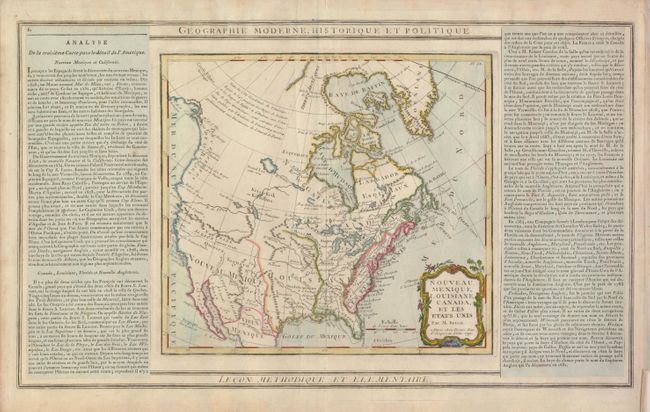
This map covers the majority of the continent, excluding Alaska and southern Mexico. The western region is virtually unknown, but notations are made concerning the recent discoveries along the Northwest coast. The River of the West flows out of Lake Winnipeg, which is connected through a system of rivers and lakes to Hudson Bay, thereby forming the long sought Northwest Passage. Another spurious river empties into San Francisco Bay. Quivira is located in present day Nevada. This is a later edition with the fledgling United States added both in the map and in the title and the date changed from 1766. The map (10 x 9.2") is flanked by columns of French text pasted on the sheet.
References: cf Seller & Van Ee #117
Condition: A
There are a couple printer's creases, else fine.