Subject: Miscellany
Period: 1817 (circa)
Publication: New General Atlas
Color: Hand Color
Size:
23.8 x 19.5 inches
60.5 x 49.5 cm
This is a nice lot of maps one of the most accurate and best produced British atlases of the nineteenth century. Thomson issued his atlas in competition with Pinkerton's Modern Atlas, using the best engravers in Edinburgh, including Kirkwood, Menzies, and Moffat, as well as the London engravers Hewitt and Neele. He added about twenty maps not found in Pinkerton, including several maps not found in contemporary atlases.
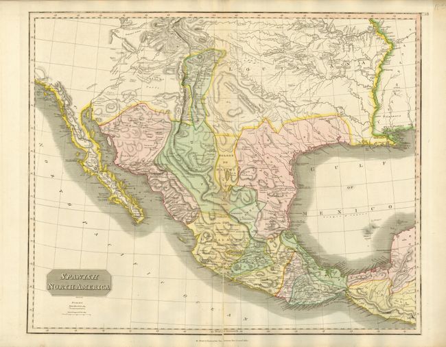
1) Spanish North America - This significant map depicts the Spanish possessions in North America. Especially noteworthy is the delineation of the great river systems, particularly the Platte flowing east and south of the Rocky Mtns. Spanish control of the Southwest is limited to part of Texas and a strip of land in present day New Mexico which includes Santa Fe and Albuquerque. In this edition, Pikes Peak is not named but is labeled as the "Highest Peak." According to Wheat, the map originated primarily from the epic Humboldt and Pike maps and to some extent the Pinkerton and Arrowsmith maps published a few years earlier. Texas appears within the province of St. Louis de Potosi, which is also labeled New Santander. The very handsome map names many Indian tribes and villages, with terrific early information on topography and watershed. Ref: Wheat [TMW] #320.
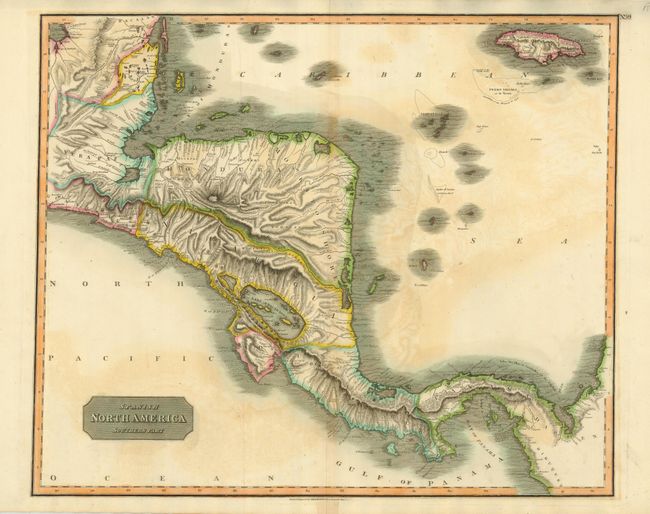
2) Spanish North America Southern Part - Large and very detailed map of the region south of the Yucatan Peninsula to South America. Includes Belize, much of Guatemala, El Salvador, Honduras, Nicaragua, Costa Rica, Panama and Jamaica. There is excellent detail of inland regions with lakes, rivers and mountains, and many offshore islands are depicted.
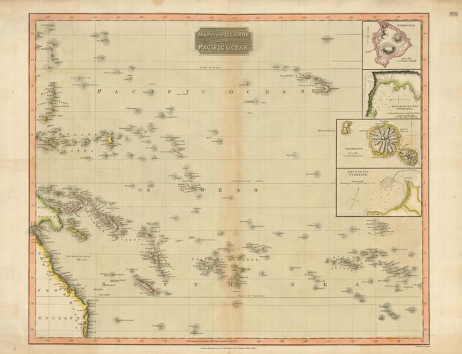
3) Map of the Islands in the Pacific Ocean - This large chart covers the central Pacific Ocean and includes insets of Hawaii and Tahiti.
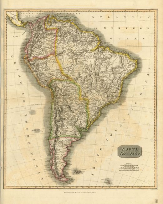
4) South America - A detailed map of the continent that includes mountains, watershed, topography, villages and towns. Interesting notations within map include "These Parts are Unknown" in Brazil, "These Parts Have Not Been Explored" near the headwater of the Amazon, and "This Country is Uninhabited" in Argentina.
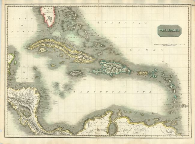
5) West Indies - The general chart covers from the southern tip of Florida and the Bahamas through to the northern part of South America, here labeled Spanish Main.
References:
Condition: C+
Original color with some fading, offsetting, centerfold splits, minor tears into the borders and tape repairs on verso (Pacific).