Subject: World
Period: 1720 (circa)
Publication:
Color: Hand Color
Size:
13.5 x 10 inches
34.3 x 25.4 cm
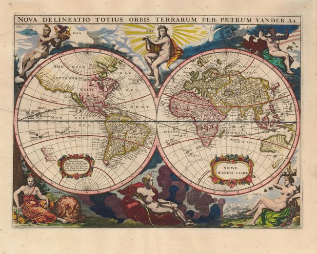
Originally published by Jacob van Meurs in 1660, and reissued here by Vander Aa, this map is based on Arnold Colom's wonderfully graphic map from the first world maritime atlas. California is an island, separated from Nova Albion, which stretches towards Asia and off the map. The western coast of New Zealand appears, as do several other important Pacific islands. Australia is partially mapped and only the southern tip of Tasmania appears. Each hemisphere includes a strap work cartouche, one with the Dutch title Niewe Werelt Caart. Superb engravings surround the map with representations of the gods Apollo and his sister Diana representing day and night with four female allegories of the elements of Fire, Air, Water and Earth.
References: Shirley #417.
Condition: A
Fine impression with a minor crease in the map and a few light spots in the blank margins.