Subject: World & Continents
Period: 1846 (circa)
Publication:
Color: Hand Color
Size:
17 x 11 inches
43.2 x 27.9 cm
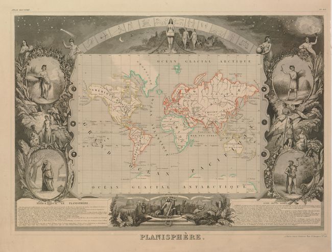
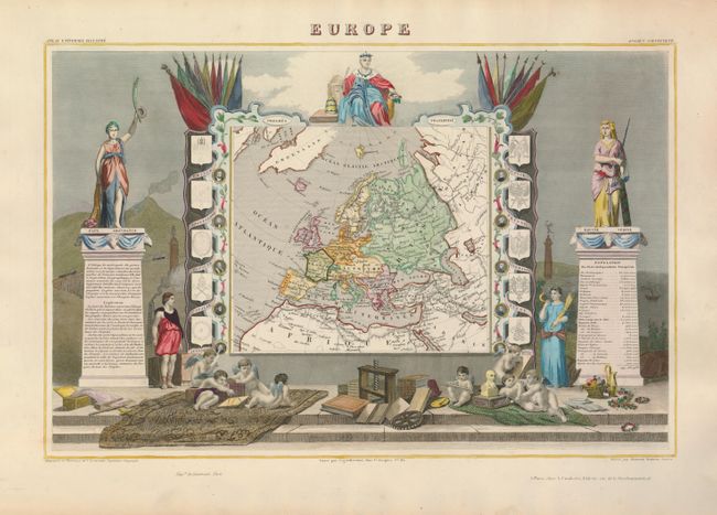
Victor Levasseur's "Atlas National Illustre" and "Atlas Universel Illustre" are among the last decorative atlases published. The maps are all lavishly illustrated with scenes of the countryside, products and activities indigenous to the region.
A nice set of world and continents from Levasseur's decorative atlases. Each map is surrounded in an elaborately engraved border containing vignettes representing the region in views, natives, plants, animals, explorers, etc. Sizes vary slightly.
1) Planisphere is presented on Mercator's projection and surrounded by fine steel engravings including vignettes representing the four seasons, allegorical figures of the continents and several mythical figures, Adam and Eve and much else of interest.
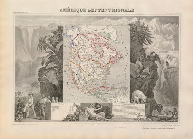
2) Amerique Septentrionale portrays the Republic of Texas, the United States extends into present-day Canada, Russia is in control of Alaska, and Mexico's northern border is according to the Treaty of 1819 (miss-printed 1810). The map is surrounded by beautifully engraved scenes of North and Central America including local animals, a ship stranded in the polar sea, and a Mayan temple.
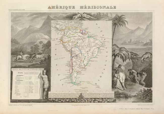
3) Amerique Meridionale is surrounded by steel engraved scenes including horses, Indians, jaguars, tapirs, and mining, as well as personifications of the rivers Amazon and La Plata at the top of the map.
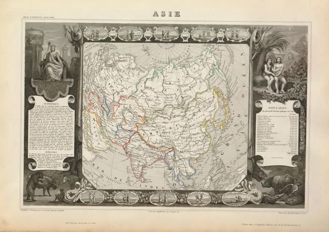
4) Asie is surrounded by steel engraved vignettes depicting costumes of the various peoples of Asia, Adam and Eve, and several exotic animals. Interesting population chart at right totaling only 638,550,000 for the entire continent.
5) This map of Europe is quite simple with color distinguishing the various countries, yet the surrounding engravings make this one of the most decorative 19th century maps. The map is framed by medallion portraits and coats of arms down each side and is set against a background of statues and allegorical figures. A large group of adorable cherubs engaged in academic pursuits fills the foreground.
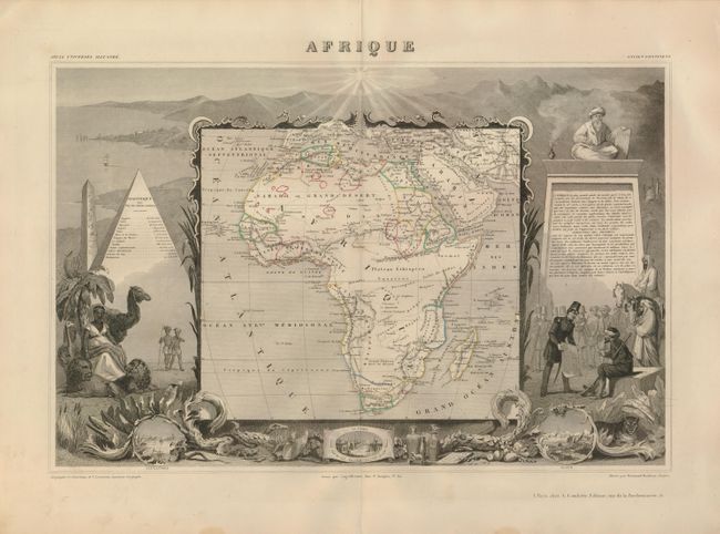
6) Afrique shows the colonial possessions and major tribal kingdoms of the continent. The interior is mostly void of detail, with the exception of the mythical Monts de la Lune, or Mountains of the Moon in the center of the continent. These legendary mountains were long thought to be the source for the Nile, dating back to Ptolemy. Stanley traced a fluvial connection from the Nile back to a mysterious snowy mountain range in Central Africa in 1888, dubbing the mountains Ruwenzori and proclaiming them the Nile source that Ptolemy described. The map is surrounded by steel-engraved scenes by Raimond Bonheur including the pyramids, wild animals, natives, the French army in Algeria and vignettes of Alexandria, Cairo, and Algiers.
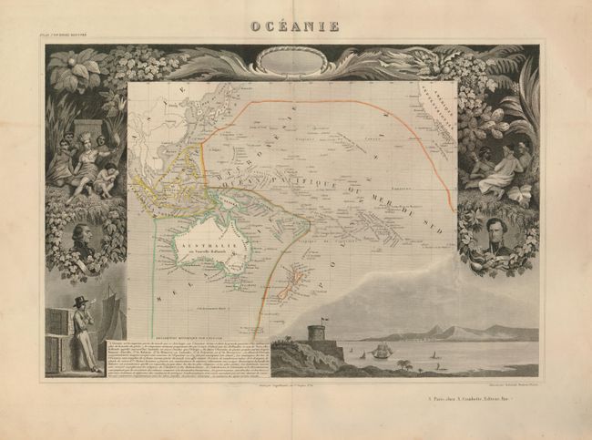
7) Oceanie covers the entire South Pacific, divided into four parts. Malaisie includes the islands of Southeast Asia. Micronesie includes the island groups between the Philippines and Hawaii. Melanesie includes Australia, New Guinea, the Solomon Islands and Fiji. The largest division of Polynesie incorporates New Zealand and rest of the islands in the Pacific. The surrounding steel engraved scenes feature the natives of the region, portraits of French leaders, lush native foliage and a harbor vignette.
References:
Condition: A
A few short tears in the margins, not affecting the maps. All with original outline color except Europe, which has lovely later full color. Planisphere has trimmed but still ample margins, Afrique has a couple spots of foxing.