Subject: New Zealand
Period: 1845 (circa)
Publication: National Atlas
Color: Hand Color
Size:
20 x 23.5 inches
50.8 x 59.7 cm
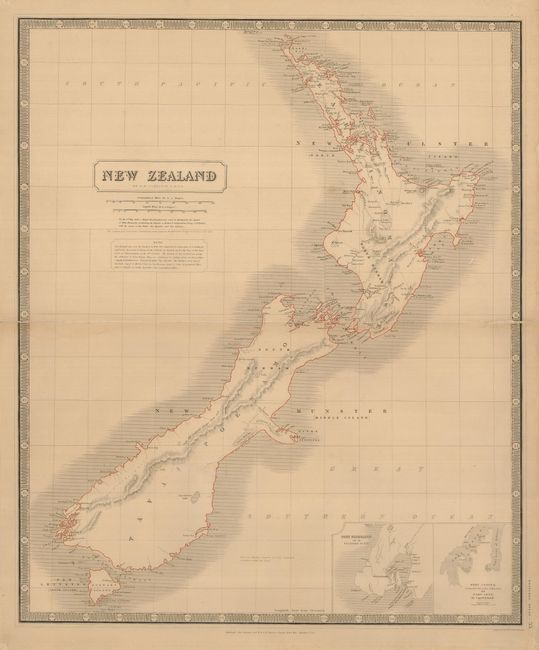
A large map of New Zealand showing the early, transitional provinces of New Ulster, New Munster and New Leinster. These divisions were created in 1841 and abolished in 1853. The islands are also carrying their Maori names of Tavai Poenamo for the South Island, and Eaheino Mauwe for the North Island. The inset at lower right has small maps of Port Nicholson and Lyttelton, formerly called Port Cooper.
References:
Condition: B+
Original outline color on a thick sheet of paper. The centerfold is separated about 1.5" into the map on each side, and is reinforced on the verso with tissue. The map is lightly toned with a couple faint spots of toning, else fine.