Antique Maps, Charts, Atlases and Globes for Sale at Auction

Old World Auctions - Antique Map Specialists


Antique Map Auction Sale No. 124 - closed 5/7/2008

Featuring 801 lots of rare antique maps, charts, pocket maps, globes and atlases
Prices Realized       Table of Contents       Search Auction


Lot #708: "Kaart van den Mond van Norton, en van de Engte van Bhering…" Capt. James Cook

Antique map chart Kaart van den Mond van Norton en van de Engte van Bh
Click to see full size image(s)

Estimate:
$100.00 - $150.00
Sold for: $75.00

Lot 708
By: Capt. James Cook
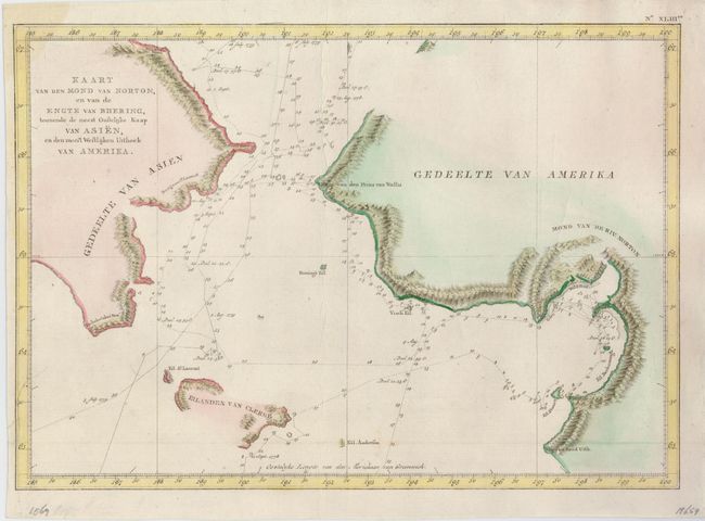
Subject: North Pacific Ocean
Date: 1801

Publication: Dutch edition of Cook's Voyages

Condition: A
See Condition Guidelines

Color: hand color

Size: 15 x 10.5 inches
38.1 x 26.7 cm

Nice map of the Bering Strait from south of Norton Sound to north of Cap du Prince de Galles and the corresponding coastline of Russia. Features include hachure representing coastal mountains, islands, place names and soundings. St. Lawrence Island, Eilanden van Clerke is partially shown; other gaps exist along the continents. Tracks of both the 1778 and 1779 exploration are delineated; Cook having done the former and Clerke the latter after Cook's death in Hawaii in Feb. 1779.

Issued folding, now flattened. There are some minor creases, still a very good example.

Search this archived auction | Antique Map Price Guide