Subject: Colonial North America and Caribbean
Period: 1703 (dated)
Publication:
Color: Hand Color
Size:
25.3 x 18.8 inches
64.3 x 47.8 cm
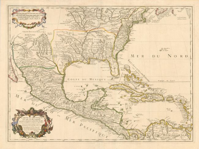
This is the third edition of this important map that is credited with accurately showing the course of the Mississippi River and its mouth for the first time. The early native settlement of Checagou (Chicago) is named on Lake Michigan, called Lac des Illinois after the native tribe. The name of Checagou refers to the wild garlic that grew abundantly there. The map influenced later delineations of the Mississippi River by Seutter, Homann, Lotter and others for many years. It is an attractive map that includes much of the present-day United States, Mexico, Central America, and the Caribbean. The British colonies are confined along the Eastern Seaboard. Florida is shown as a Spanish possession taking in the entire southern region and the Southwest is labeled Nouveau Mexique. The decorative cartouche was engraved by C. Simmoneau.
References: Cumming #137; Tooley (Amer) #50, pp. 23; Wheat pp 58-61; Wagner #474; Schwartz & Ehrenberg pl. 82
Condition: A
A sound sheet with a good impression and a light crease. The centerfold is reinforced in the lower margin, not affecting the map.