Subject: North America
Period: 1889 (published)
Publication: The Extermination of the American Bison...Its Discovery and Life History
Color: Printed Color
Size:
17.4 x 22 inches
44.2 x 55.9 cm
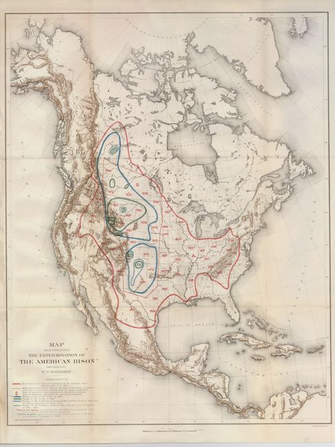
This poignant map was prepared by W.T. Hornaday for a report to the U.S. National Museum, Smithsonian Institution. It traces in red the boundary of the area once inhabited by buffalo. The area in blue and green reflects the tragic and systematic destruction of these herds. The numbers in green represent the location and number of the wild buffalo in existence by January 1, 1889. Barely 800 bison were known to exist when this map was published. A historically important map that was published in the Annual Report of the Board of Regents of the Smithsonian Institution for the Year Ending 1887, Part II, 1889.
References:
Condition: B+
Issued folding, now pressed and backed with archival tissue. The left binding side has paper added to facilitate framing, and the slightest hint of fold toning, else very good.