Subject: North America
Period: 1795-1815 (circa)
Publication:
Color: Hand Color
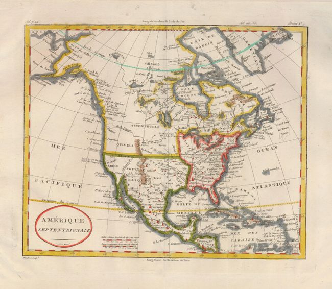
An attractive pair of maps, both with crisp impressions and rich coloring. The first, Amerique Septentrionale (8.7 x 7.2") shows the United States' western boundary at the Mississippi River, and the northern boundary of Mexico at the 40th parallel. The western portion of the continent is mostly blank, but does include the Rocky Mountains, and the R. de l' Ouest (River of the West). Texas (Cenis) is named, but not delineated. Alexandre Blondeau, Paris, c.1815. Recent outline color refreshes the original coloring. A near fine example less six small wormholes in upper margin, closed on verso, and a paper abrasion in left margin. Folding, as issued. Grade A.
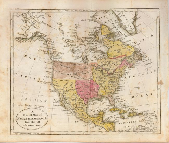
The second, A General Map of North America from the Best Authorities (8.8 x 7.4") shows a mostly blank Great Basin, and a long River of the West extending from an enlarged Puget Sound eastward nearly to the Mississippi River. The map has good watershed detail, locates the source of the Mississippi River, and names some Indian tribes, forts, etc. Texas (Cenis) is located within the huge Louisiana Territory, but not delineated. Russell, John C., c.1795. The map is foxed and has some offsetting. Folding, as issued. Grade B.
References:
Condition:
See descriptions.