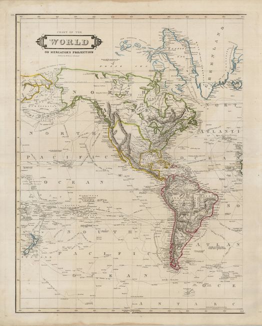
Subject: Western Hemisphere
Period: 1830 (circa)
Publication:
Color: Hand Color
Size:
16 x 21 inches
40.6 x 53.3 cm
This map of the Western Hemisphere is the left side of an uncommon, double-page map of the world. The map is filled with the tracks of explorers and circumnavigators including Christopher Columbus and Captain Weddel's exploration of Antarctica in 1823. There is excellent detail of the South Pacific and New Zealand is well-delineated. Many Indian lands are noted in North America. The middle of South America is "Mostly Unknown." The right side border is left open, obviously to join this sheet with the eastern hemisphere, not present here.
References:
Condition: B+
The map has original hand coloring. There are a few lights stains on the centerfold. Margins have a couple of short tears, not affecting the map.