Subject: North Pacific Ocean
Period: 1795 (circa)
Publication:
Color: Black & White
Size:
25.3 x 15 inches
64.3 x 38.1 cm
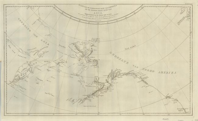
This map centered on the Bering Strait features soundings and the dates of Cook's third voyage in his search for a Northwest Passage. Cook probed north along the Oregon coast in bad weather to Nootka Sound, where he rested and refitted his ships. They sailed on to the Alaskan and Chukotskiy peninsulas and from there into the Bering Strait. Cook reached 70° 41’ N before being forced back by the pack ice off Icy Cape. The expedition came south down the Russian coast and east to Norton Sound. Cook's expedition then sailed south to Hawaii, where Cook was killed in a dispute with the natives. His second-in-command Clerke took over the expedition and explored further in the Pacific before returning north to continue the quest for the Northwest Passage.
References:
Condition: A+
Folding, as issued. There is a a very small paper flaw at lower left in a blank area, still fine.