Subject: Africa
Period: 1792 (dated)
Publication:
Color: Hand Color
Size:
23.3 x 18.2 inches
59.2 x 46.2 cm
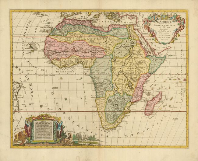
This handsome, large map of Africa was copied from Jaillot's map of more than a century earlier (1674). The cartography is typical for the seventeenth century with the Nile originating in two large lakes below the equator. The River Zaire (Congo) also arises from Lake Zaire. The Kingdom of Monomotapa is shown with its capital on the Rio de Spirito Santa, and Vigiti Magna is also depicted. The map is richly embellished, also in the seventeenth century style, with two elaborate cartouches.
References: Norwich #109.
Condition: A
A sound example with original on fine laid paper. There are a couple of faint printer's creases in the lower left, and some faint marginal soil.