Subject: Africa
Period: 1780-1890 (circa)
Publication:
Color: Hand Color
A group of maps of Africa spanning the late 18th and 19th centuries.
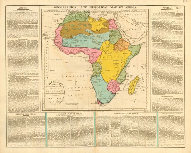
1)Africa Drawn from the best Authorities, for the Illustration of Lavoisne's Genealogical, Historical, Chronological, & Geographical Atlas. An attractive map showing the Mountains of the Moon, with otherwise sparse interior detail. By J. Aspin, dated 1813. The map is (12 x 11.5") surrounded by text on three sides (20 x 15.75"). It has nice original color and some light offsetting, grade B+
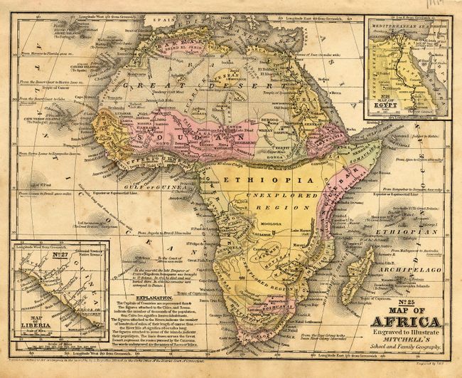
2)No. 25 Map of Africa Engraved to Illustrate Mitchell's School and Family Geography. A school atlas map with large unexplored areas in the southern part of the continent. Inset with No. 26 Map of Egypt and No. 27 Map of Liberia. (10.3 x 8"). Original color. Map is foxed, binding holes evident in top margin. Grade B.
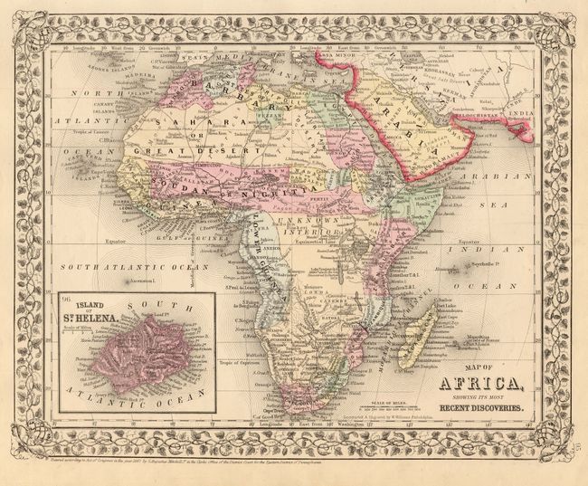
3)Map of Africa, Showing Its Most Recent Discoveries. Lovely map of the continent with an enlarged, detailed inset of the Island of St. Helena, surrounded with decorative floral borders, inset with a map of St. Helena. By S. A. Mitchell, 1867. Fine original coloring, and good impression and detail throughout. (18 x 15.5"). Binding edge a bit ragged. Grade A.
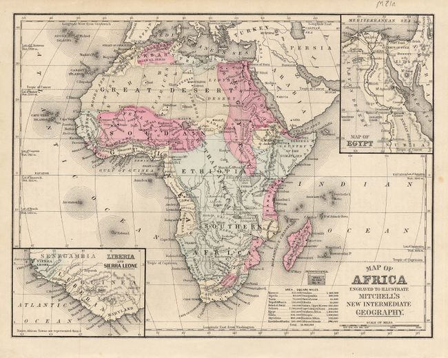
4)Map of Africa Engraved to Illustrate Mitchell's New Intermediate Geography. 1881. Insets of Map of Egypt and Liberia and Sierra Leone. A tiny inset of the state of Pennsylvania provides size comparison. Text on verso. (10.8 x 8.3"). Original hand coloring. Grade A.
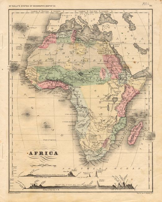
5)Africa, from McNally's System of Geography, by J. Wells, circa 1890. Along the bottom, elevations are shown for a line through west Africa to the islands of Madeira and Teneriffe and from the Cape of Good Hope north to Massuah on the Red Sea. Text on verso. (8.3 x 10.5"). Dampstaining in margins and a bit age toned. Several small spots in image. Grade B+.
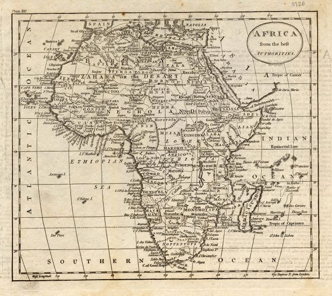
6)Africa from the best Authorities. Plate XXI. Anonymous, circa 1790. Black and white map shows excellent coastal and interior detail (8.5 x 7.3"). Some toning along folds and light soiling in margins. Grade A.
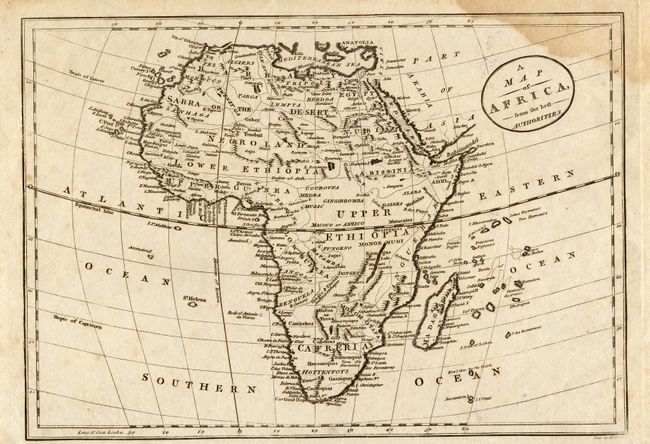
7)A Map of Africa, from the best Authorities, circa 1780. Locates Sarra or the Desert and the Rift Valley. A black and white map with excellent coastal detail, and quite a bit of interior detail (11 x 7.8"). It is damp stained at top, and the margins are toned with some chips. Grade B.
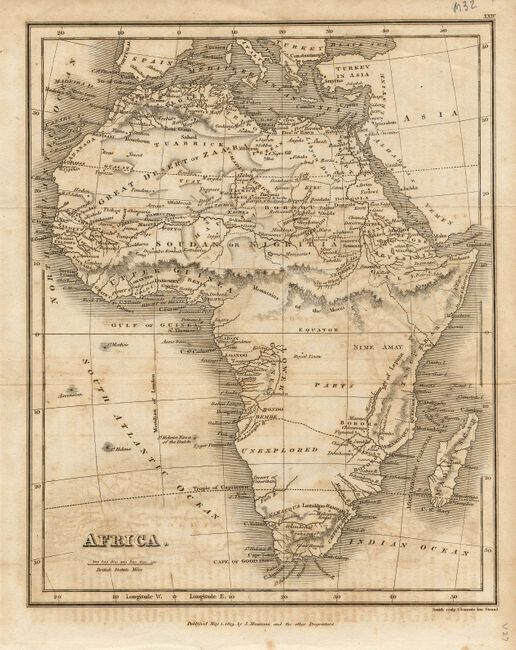
8)Africa, dated 1819, engraved by Smith and published by J. Mawman. This black and white map locates the Great Desert of Zaara, the Mountains of the Moon and a large unexplored region in the south (7.5 x 9.5"). Some offsetting and foxing, grade B.
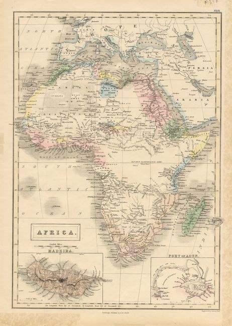
9)Africa, by Sidney Hall, circa 1850. A hand colored map with insets of Madeira and the Port of Aden. (10.3 x 14.5"). Several edge tears, some repaired with non archival tissue tape on verso. Grade B.
References:
Condition:
See individual descriptions.