Subject: Africa
Period: 1675 (circa)
Publication:
Color: Hand Color
Size:
22.8 x 19.3 inches
57.9 x 49 cm
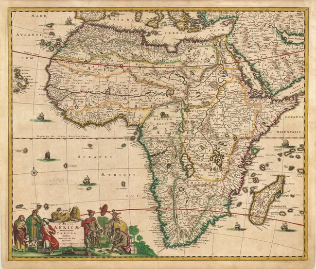
A beautiful map of the continent filled with details typical of the late 17th Century. The Nile appears according to the ancient pattern of Ptolemy, arising from the two lakes of Zaire and Zafflan. De Wit's depiction of the southeastern coast includes numerous deep inlets and several rivers and lakes at the southern tip not seen on other maps of the period. The kingdom of Monomotapa extends as far south as the Rio de Infante and there are few names in the interior of the Cape. The fictitious N. I. De Sta. Helena appears in the South Atlantic. The interior is decorated with elephants, ostriches, monkeys, lions and rhinoceros, and seven small ships sail in the oceans. The well-engraved title cartouche features Moors and Africans with a child seated on an elephant and two lions perched atop the cartouche. This map was copied by several other cartographers including Danckerts and De Ram.
References: Betz #114.2; Norwich #48.
Condition: B
A dark impression on a sound sheet with original color. There is some minor uneven toning and some small circles around a few of the cities in old ink. The verso has handwritten text roughly as old as the map, with some faint show through to the front.