Catalog Archive
Auction 123, Lot 713

"Carte des Isles du Japon et la Presqu Isle de Coree, avec les Costes de la Chine depuis Pekin jusq'a Canton", Bellin/Van Schley
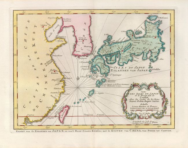
Subject: China, Korea & Japan

Period: 1773 (published)

Publication: Raynal's Atlas Portatiff

Color: Hand Color

Size:
11.2 x 8.3 inches
28.4 x 21.1 cm
Download High Resolution Image
(or just click on image to launch the Zoom viewer)

A handsome map Japan, based on the cartography of Kaempfer-Scheuzer. The map extends to Korea, a portion of the coast of China to Canton, the Ryukyu Islands and Taiwan (Formosa). The map is titled in both French and Dutch, with some place names in both as well. A decorative title cartouche fills the lower right corner.

References: Walter #83, OAG #106.

Condition: A

Superb impression on fine laid paper with a couple of minor spots in the right margin, not affecting the map.

Estimate: $300 - $400

Sold for: $275

Closed on 2/20/2008

Archived