Catalog Archive
Auction 123, Lot 707

"Carte de Tartarie Dressee sur les Relations de Plusieurs Voyageurs de Differentes Nations…", Delisle/Covens & Mortier

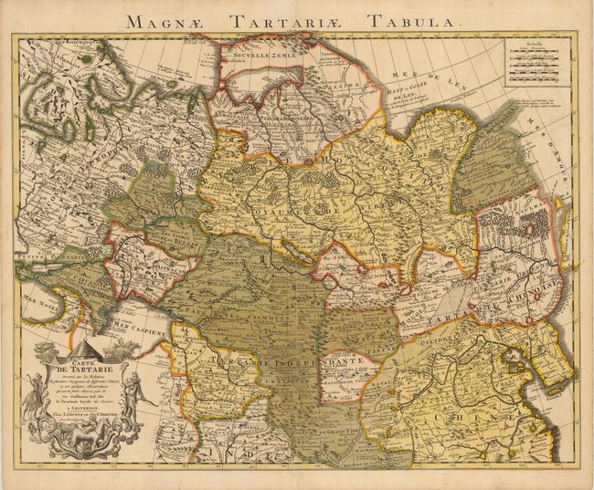
Subject: Northern Asia, Russia, China

Period: 1733 (published)

Publication: Atlas Novus as Usum Serenissimi…

Color: Hand Color

Size:
24.5 x 19.8 inches
62.2 x 50.3 cm
Download High Resolution Image
(or just click on image to launch the Zoom viewer)

An expansive map that includes Russia, Northern China and Tibet, from Novaya Zemla in the north to Afghanistan. The Pacific coast shows a portion of the Terre d'Eso, with the small Isle de Amour shown above, but not Japan. The map is fully engraved with forests and mountains and, for the period, has quite good detail of cities and towns. The Great Wall is graphically depicted, as are the extensive trade routes. A decorative cartouche surrounds the title in the lower left. Titled above map: Magnae Tartariae Tabula.

References:

Condition: B

Original color that has oxidized, with a small verdigris crack on the southwestern border of Siberie. A paper repair reinforces a split on the centerfold.

Estimate: $300 - $375

Sold for: $400

Closed on 2/20/2008

Archived