Subject: Arabia, Red Sea, East Africa
Period: 1720 (circa)
Publication: Le Neptune Francois
Color: Hand Color
Size:
29.6 x 20.6 inches
75.2 x 52.3 cm
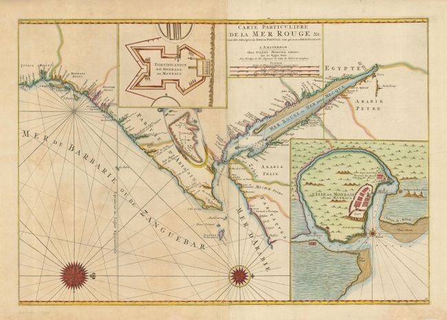
Dramatic sea chart covering the Red Sea and the Gulf of Aden with portions of Yemen and the east coast of Africa from modern Tanzania to Suez. There are three inset maps; a colorful map of Fort Mombassa, Mombassa Island, and a small one of the island of Socotra. Babel Mandel is prominent in the seaway between the southern Red Sea and the Gulf of Aden, and Zanzibar also appears, with many names along the coast. The map is oriented with north to the right by two spectacular compass roses.
References: Norwich #262.
Condition: A
Excellent impression printed on sturdy paper. Generous margins with two small worm tracks, not affecting map. Centerfold separation repaired on verso with archival tape.