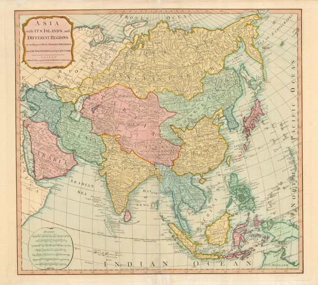
Subject: Asia
Period: 1799 (dated)
Publication: A New and Elegant Imperial Sheet Atlas…
Color: Hand Color
Size:
20.8 x 19.3 inches
52.8 x 49 cm
A handsome map of the continent extending from the Arctic to the Philippines and portions of New Guinea and Australia (New Holland). As noted in the title, the Pacific contains information from Capt. Cook's explorations. Japan still has an unformed Hokkaido (Jesso), and the Bering Strait is shown. The map presents an up-to-date view of Southeast Asia reflecting the growing English presence in the region. An elegant cartouche surrounds the title, and the scale of miles contains seven standards, including Arabian, Persian, and Chinese. This map is a reduced version of Sayer's large four-sheet map (1787) based on the cartography of D'Anville.
References:
Condition: B+
A sound example with the centerfold reinforced with tissue on the verso. The lower margin has a couple of short tears, repaired with tissue.