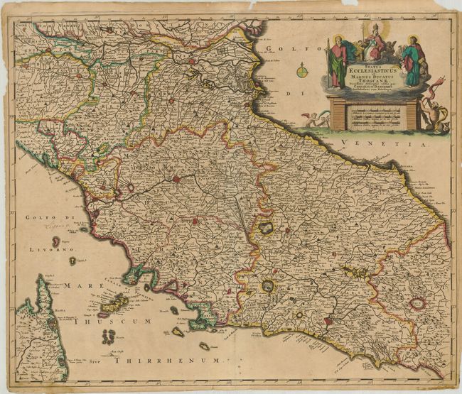
Subject: Italy, Tuscany
Period: 1690 (circa)
Publication:
Color: Hand Color
Size:
23.5 x 19.5 inches
59.7 x 49.5 cm
A well-engraved map of Tuscany, including Mantua, Florence, Rome, and extending to Elba and a portion of Corsica. The map is filled with detail, including a road that goes from Piacenza to Rimino on the Venetian Gulf. The larger cities are shown as fortified citadels, and the topography is noted pictorially. There is an elaborate cartocuhe in the upper right, incorporating the distance scale. It is topped by the Virgin Mary, who is flanked by St. Michael and St. Peter.
References:
Condition: C+
Slightly faded original color. The margins have been trimmed for inclusion in a composite atlas. The margins also have some tears and loss with some mouse grazing in the right, just affecting the neatline. The map has some scattered stains and a few old ink notations.