Subject: Spain
Period: 1700 (circa)
Publication:
Color: Hand Color
Size:
22.8 x 18.5 inches
57.9 x 47 cm
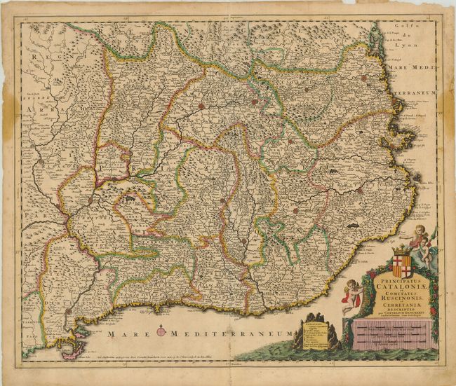
A decorative map of the Spanish region of Catalonia covering the Mediterranean coastline from the French border via Barcelona to Tortosa. The map is filled with fortified cities, pictorial representation of the topography and many roads. The decorative cartouche incorporates the scale of miles, and is topped with a coat of arms, garland and attended by putti.
References:
Condition: B
A dark impression on a sheet with nice original color. There is some faint mildew and abrasion in the lower part of the map, and a pair of stains on the right and left margins that just enter the map borders, with some paper reinforcements on the right verso. Top margin with some loss, well away from the map.