Subject: Paris, France
Period: 1840 (dated)
Publication:
Color: Black & White
Size:
33 x 22.3 inches
83.8 x 56.6 cm
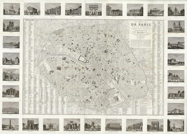
A large and seldom-seen map of Paris surrounded by 30 architectural views joined to the edges, overall size 42.5 x 29.8". The map shows Old Paris as it was before Hausmann began his razing and rebuilding of the city in the 1850s, with only 12 arrondissements, compared to the 20 it would have by 1860. The buildings shown include the Arc de Triomphe, the Louvre, Place Vendome, the Obelisk, Tuilerries, Notre Dame, and other lesser known buildings of note. This map was separately issued, and published by Danlos.
References:
Condition: B+
A dark impression on a sheet with folds as issued and faded original outline color. There are a few spots of toning and some repaired tears in the map. It is still in exceptional condition for a separately published map.