Subject: France
Period: 1574 (circa)
Publication: Theatrum Orbis Terrarum
Color: Hand Color
Size:
19 x 13 inches
48.3 x 33 cm
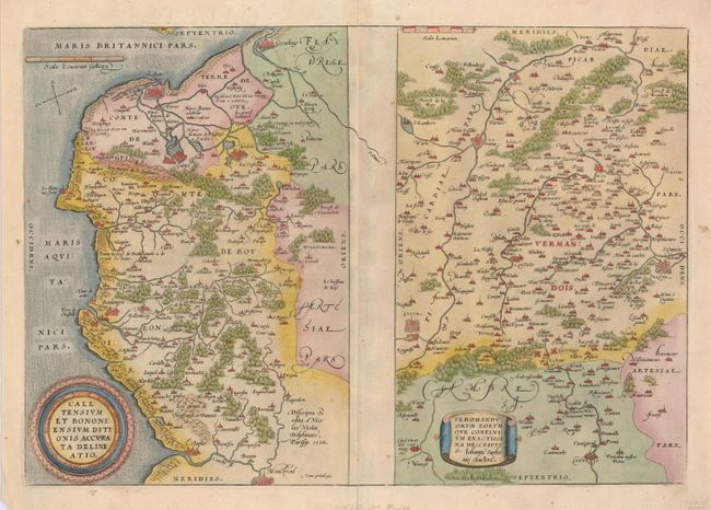
Two maps on a folio sheet. Calentensium covers the coastline between Calais and Estaples in very good detail, based in part on a four-sheet map by Nicolas de Nicolay. Veromanduorum covers a small region surrounding Saint-Quentin in northern France. The cartographical source of the map was Jean de Surhon who received royal privilege to make a map of the region in 1557. Each is covered with tiny forests and cities and has a decorative title cartouche. Latin text on verso and the page number 15, indicate that this was from the first state of Ortelius' map of this region published in 1574 and 1575. This map was replaced in 1598 with a map showing the Veromanduorum region with north at the top.
References: Van den Broecke #44.
Condition: B+
Nice impression on a sound sheet with a few faint spots. Margins trimmed, but still ample with some repairs on the verso.