Subject: Netherlands
Period: 1680 (circa)
Publication:
Color: Hand Color
Size:
21 x 18 inches
53.3 x 45.7 cm
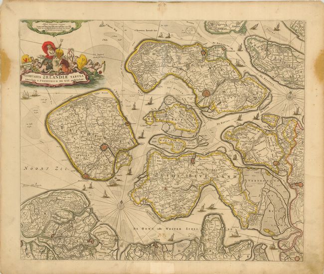
A handsome map of Zeeland detailing the islands of Walcheren, Beveland, Schouwen and Tholen within the Schelde estuary, and Zeelandic Flanders in the south. The map details the topography, roads and cities, including Middelburgh, Tolen and Berg op Zoom. Neptune sits astride the aquatic-themed cartouche at top.
References:
Condition: B
Good impression and original color. The map has a few small stains in the bottom. The margins have some stains, and with one tear nearly invisible, entering 1" into the map, repaired with paper on the verso. Some worming in the top margin has been repaired with paper as well. This would frame very well and these small defects would not be visible.