Catalog Archive
Auction 123, Lot 450

"Carte Reduite de l'Ocean Meridional Contenant Toutes les Costes de l'Amerique Meridionale depuis l'Equator jusqu'au… les Costes d'Afrique qui leur sont opposees…", Bellin, Jacques Nicolas

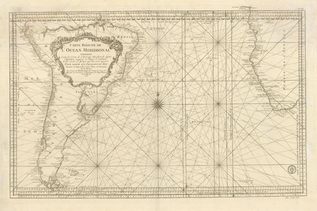
Subject: South Atlantic Ocean

Period: 1753 (dated)

Publication: Hydrographie Francoise…

Color: Black & White

Size:
34.5 x 21.5 inches
87.6 x 54.6 cm
Download High Resolution Image
(or just click on image to launch the Zoom viewer)

Handsome sea chart of the Southern Atlantic with a near complete South American continent (south of the Amazon River) and South Africa included. Detail is largely confined to the coastlines. Rhumb lines and a large compass rose make this a very attractive large chart. The Prime Meridian is shown through l'Isle de Fer, I'Isle de Teneriffe, London and Paris. The Falkland Islands are named as Isles Nouvelles, and the amorphous coast contains a note in French that it is not yet known. The stamp of the Depot le la Marine is shown on the right with the price below the neatline noted as Prix. Trente Sols.

References:

Condition: B

A strong sheet with a dark impression. There is a very small worm hole on the centerfold just above the Tropic of Capricorn. A damp stain has intruded into the upper left corner of the map.

Estimate: $300 - $350

Sold for: $220

Closed on 2/20/2008

Archived