Subject: Hispaniola
Period: 1802 (dated)
Publication: Recueil de Plans et Cartes…
Color: Black & White
Size:
18.2 x 14.5 inches
46.2 x 36.8 cm
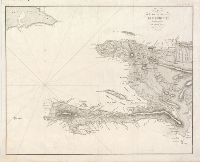
This uncommon chart of present day Haiti illustrates the region involved in France's military campaigns against the Haitian army led by Toussaint in Haiti's War for Independence. The map is presented with fine detail and a crisp engraving. The eastern end of Cuba is shown, with Guantanamo Bay the most prominent feature. The tiny island of La Navace sits due west of Tiburon. Interior details include roads, towns, villages, rivers and more. Along the coast are soundings, anchorages, shoals, etc. With rhumb lines and decorative flourishes surround title.
References:
Condition: B+
Issued folding, now pressed. There is some light soil in image and tiny edge tears well away from map. Hinge remnants on verso.