Subject: Lesser Antilles
Period: 1534 (published)
Publication: Isolario
Color: Black & White
Size:
5.7 x 3.2 inches
14.5 x 8.1 cm
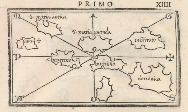
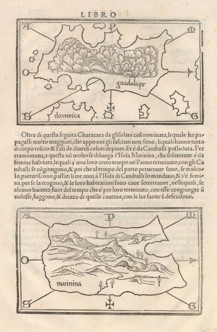
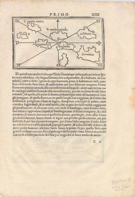
Lovely series of three small maps printed on two sides of a full sheet (8.5 x 11.2") of Italian text. On the recto is an untitled map of several West Indian islands including, S. Maria Antica (Antiqua), Santa, S. Maria Roronda, Moserato (Montserrat), S. Martino, Buchima, Dominica. On verso are maps of Guadalupe and Matinina (Martinique), both with east oriented at the bottom, and featuring pictorial representations of the mountainous or forested interiors. Bordone's Isolario was one of the earliest and most important works of its time. It is remarkable for being the first atlas covering the entire world not based on classical geography, but rather on contemporary information. Bordone was an illuminator and wood-engraver working in Venice, when he was given permission by the Senate to print maps of Italy and the world. None of those maps have survived and his only remaining works are the maps from the Isolario (Island Book). Size given is for each individual map.
References:
Condition: A
Very nice, dark impression. A few very light foxing spots and one marginal foxed or stained area at edge.