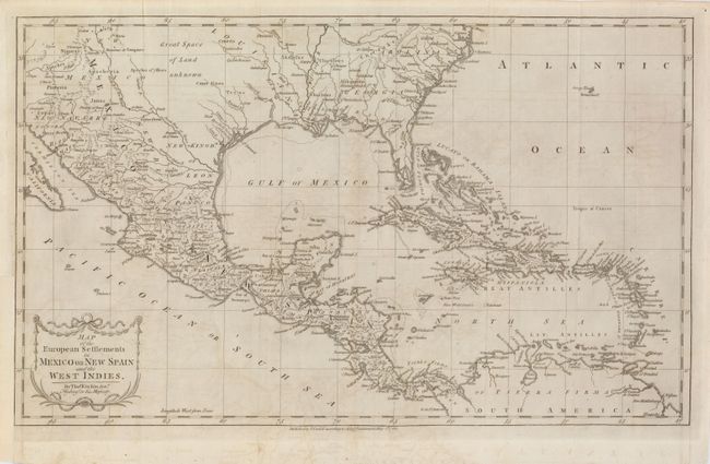
Subject: Gulf of Mexico and Caribbean
Period: 1783 (dated)
Publication: Robertson's History of America
Color: Black & White
Size:
20 x 12 inches
50.8 x 30.5 cm
This detailed and expansive map covers all of the southern United States north to the Carolinas at Cape Henry. The map continues west through the region labeled Great Space of Land unknown to the southern tip of Baja California. All of the Caribbean is shown, naming the Great Antilles, Cuba, and the Bahamas, with the Windward and Leeward together identified as the Caribbe Is. It is filled with place names and rivers and Indian tribes. The map is decorated with a delicate title cartouche.
References:
Condition: B
A dark impression on a sheet of laid paper with some faint offsetting. Lower margin with repaired tear just into border. Binding trim at left has been replaced to accommodate framing and a 1.25" binding tear has been professionally repaired.