Subject: Gulf of Mexico and Caribbean
Period: 1750 (circa)
Publication:
Color: Black & White
Size:
32 x 21.3 inches
81.3 x 54.1 cm
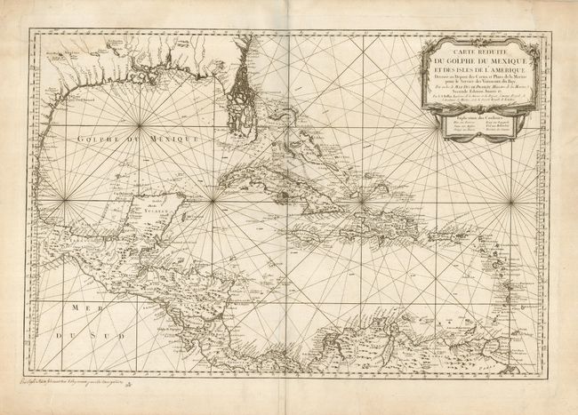
This large, impressive chart of the Gulf of Mexico and the Caribbean shows the Florida Peninsula as a maze of islands. The map was clearly meant to facilitate sailing, with loxodromic lines, the locations of safe anchorages, navigational hazards and the directions of major currents. A lovely cartouche fills the upper right, with the color key underneath, however this issue is uncolored. Second state, as noted in the cartouche, but this uncommon issue is without the seal of the Depot de la Marine, and the price is written by hand contemporary to the map in the lower left margin. The last portion of the date has been excised as well. This would have been issued and sold separately.
References: cf Tooley (MCC-96) #747.
Condition: B
A nice impression on thick paper, with the centerfold reinforced on the verso with tissue. There are some repaired tears in the upper edges (2") and side (just entering map) that have been repaired with paper and tissue on the verso. Still a good example for a working map.