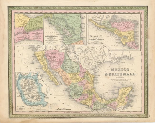
Subject: Mexico and Central America
Period: 1850 (dated)
Publication: New Universal Atlas
Color: Hand Color
Size:
15 x 12 inches
38.1 x 30.5 cm
This pre-Gadsden Purchase map extends into present day Arizona and New Mexico with the border following the Gila River. Across the top are large insets of The Isthmus of Tehantepec Showing the Proposed Route from the Gulf of Mexico Sea to the Pacific Ocean, The Isthmus of Nicaragua Showing the Proposed Routes from the Caribbean Sea to the Pacific Ocean, and Guatemala or Central America and inset at bottom left is Valley of Mexico with its two large lakes and Mexico City. The map locates and names many Indian tribes. Early California towns are named including Los Angeles, plus the three missions of San Juan, San Luis Rey and San Diego. The Baja is labeled Lower California.
References:
Condition: B+
Fine original hand coloring. Some damp stains in the margins, and a spot or two in the map.