Subject: Southwest United States & Mexico
Period: 1825 (dated)
Publication: Atlas Universel
Color: Hand Color
Size:
14.5 x 20.3 inches
36.8 x 51.6 cm
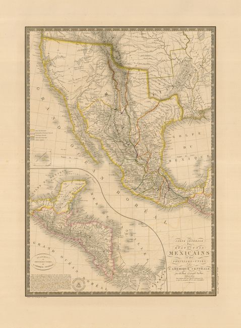
This is a very attractive map showing Mexico still in possession of California, the Southwest, and Texas, which is named, but not yet delineated. The western topography is represented in hachure and is based on the expeditions of Lewis and Clark, Pike and Long. Notably, it is the first to depict the Sacramento and San Joaquin Rivers. There are also several other rivers on the West Coast still hinting at a possible navigable connection between the Atlantic and Pacific. The map includes an inset titled Guatemala ou Provinces-Unis de l'Amerique Centrale and a color key that identifies the boundaries of the United States, Great Britain, Mexico and Central America. The author's copyright is blind stamped into the paper at the bottom of the inset. An attractive keyboard style border surrounds the map.
References: Wheat [TMW] #361.
Condition: B+
There is some light offsetting in the map and some minor foxing in the wide original margins, well away from the map.