Subject: Virginia
Period: 1827-57 (dated)
Publication:
Color: Black & White
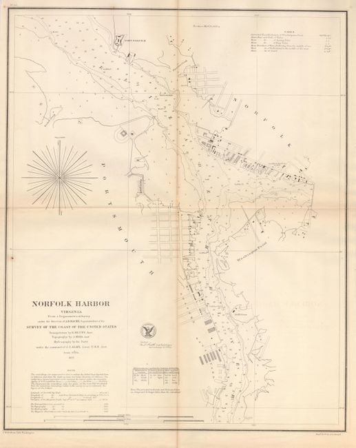
The first map was produced in 1857 by the U.S. Coast Survey, Wash. D.C. (15.5" x 19.3"). This chart shows detailed street plans of Norfolk and Portsmouth along the coast, with good detail of Gosport and the Navy Yard. Notes give navigational information. The chart is filled with information for sailors including soundings, which are connected by lines of constant depth, an early use of such lines; shows Fort Norfolk, Washington Point, St. Helena, and more. Signed in the plate by M.L. Smith, Capt. Topl. Engrs, Asst. in charge of Office. Triangulation by E. Blunt and topography by J. Seib, under the command of J.J. Almy, Lieut.
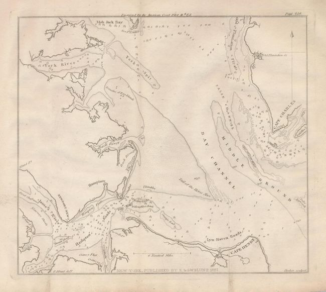
The second map was engraved for the American Coast Pilot, New York by E. & G.W. Blunt, 1827 (8.3" x 7.5"). This chart details the southern portion of Chesapeake Bay around Hampton. It extends north to show Mob Jack Bay and Old Plantation Flats. Shows Cape Charles, Cape Henry and its lighthouse, Lyn-Haven and Hampton Roads, the York Spit, Black River and more. Locates the James, Black and York Rivers. Soundings and shoals are located, such as the Tail of the Horse Shoe. Engraved by Hooker.
References:
Condition: B+
The first is folding as issued. With a little toning along one fold, one marginal split and a rust spot at left margin, else very good. The second is folding, as issued and very good.