Catalog Archive
Auction 123, Lot 332

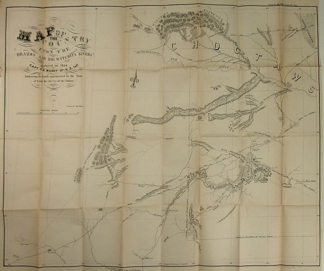
"Map of the Country Upon the Brazos and Big Witchita Rivers Explored in 1854...Embracing the Lands appropriated by the State of Texas for the Use of the Indians", U.S. War Dept.

Subject: Texas

Period: 1856 (published)

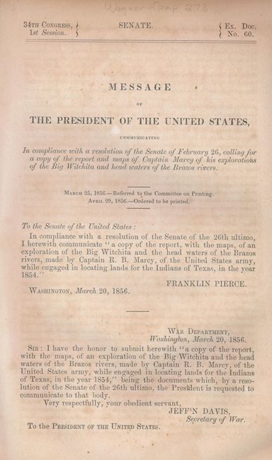
Publication: Senate Doc. 60, 34th Congress 1st Session

Color: Black & White

Size:
31 x 25.5 inches
78.7 x 64.8 cm
Download High Resolution Image
(or just click on image to launch the Zoom viewer)

This large and detailed map covers the northeastern part of Texas and a portion of Oklahoma, just north of the Red River, which is noted as Choctaw territory. Filled with details, it includes many place names, wagon roads, forts, reservations, woodlands, bayous, etc. From the 1854 explorations of Capt. R.B. Marcy of the 5th Infantry, this important map folds into the original report "Message…Calling for a Copy of the Report and Maps of Captain Marcy of his Explorations of the Big Wichita and Head Waters of the Brazos Rivers." The 47-page report (6" x 9") contains Marcy's long and detailed report titled "Explorations of the Big Wichita, Etc." Seldom offered together.

References: Wagner & Camp #278.

Condition: B+

Very nice example of the map that would be fine except for a bit of fold toning at upper right and short closed tear. The report has separated into two parts.

Estimate: $300 - $400

Sold for: $425

Closed on 2/20/2008

Archived