Subject: Texas
Period: 1845 (dated)
Publication: Tanner's New Universal Atlas…
Color: Hand Color
Size:
15 x 12 inches
38.1 x 30.5 cm
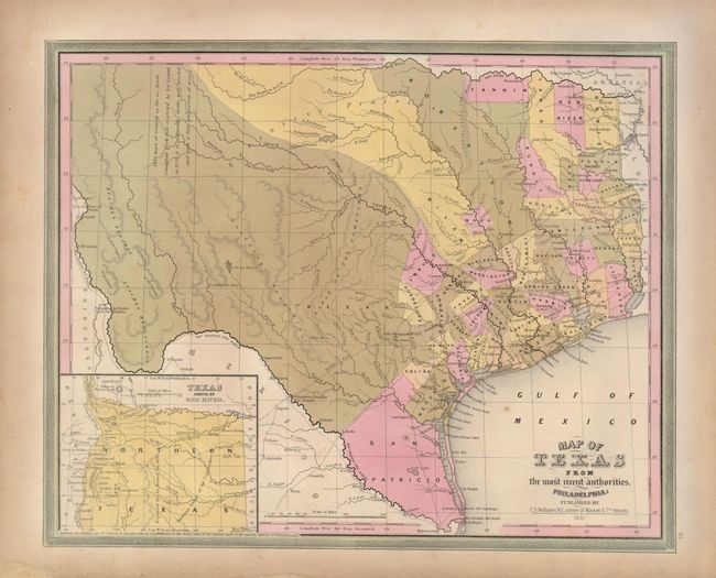
This is the rare first edition showing Texas as a Republic just prior to its annexation into the Union. The map portrays early counties, towns, and villages. It shows all of Texas with the panhandle in an inset titled, "Texas North of the Red River" at lower left. The panhandle extendes north to the Green Mts., just west of Pikes or James Peak in present-day Colorado, and west to the Rio Grande River, thus incorporating Santa Fe and Taos. There is a comment taken from Arrowsmith's 1841 map in West Texas that the area "as far as North Canadian Fork was explored by Le Grand in 1833, [and] it is naturally fertile, well wooded, and with a fair proportion of water." San Patricio County occupies the south tip, while Bexar, Milam and Robertson counties take up the majority of the western region. Several early roads are depicted including the Presido Road and Fort Alamo, mines, and the Presidios of Rio Grande, del Norte el de las Yuntas, del Paso del Norte are identified. This scarce map was included in the 1845 Carey & Hart edition of Tanner's New Universal Atlas shortly before the atlas and plates were sold to Samuel Augustus Mitchell.
References: Day (TX) #108; Phillips (A) #3553-35.
Condition: A
A nice example with lovely original color. There are two tiny specks of foxing in the map. The margins have some repairs and minor edge defects, not affecting the map.