Catalog Archive
Auction 123, Lot 327

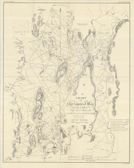
"Chart of Narraganset Bay Surveyed in 1832 by Capt. Alex S. Wadsworth…", U.S. Navy Dept.

Subject: Rhode Island

Period: 1832 (dated)

Publication: American State Papers, Naval Affairs Vol. IV, No. 489

Color: Black & White

Size:
20.6 x 26 inches
52.3 x 66 cm
Download High Resolution Image
(or just click on image to launch the Zoom viewer)

An attractive and finely engraved chart with many interesting features. The chart provides tidal information, magnetic variations, latitudinal and longitudinal information and has a pair of distance scales showing geographical and nautical miles. Topography, marshes, vegetation, soundings and grid detail of Newport, Bristol and Wickford are included on this chart that was originally surveyed in 1832 by Capt. Alex L. Wadsworth, Lieut. Thos. R. Gedney, Charles Wilkes, Jr., and Geo. L. Blake. Title is in beautifully executed calligraphy.

References:

Condition: A

A small amount of faint offsetting, and a few, short fold intersection splits have been repaired with archival tape on verso.

Estimate: $200 - $300

Sold for: $150

Closed on 2/20/2008

Archived