Subject: Minnesota
Period: 1856 (dated)
Publication:
Color: Black & White
Size:
5 x 7.3 inches
12.7 x 18.5 cm
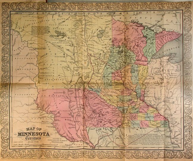
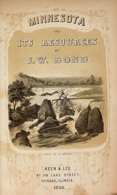
Very interesting book describing the territory's history, geography, climate, agriculture and resources. The book contains three copper engraved views; Suspension Bridge Between St. Anthony and Minneapolis, Minnehaha Falls, and St. Paul as it is in 1856, and two lithographed views; St Paul on the frontis, and the Falls of St. Anthony on the title page. A very nice foldout Map of Minnesota Territory by J.H. Young & Charles Desilver is bound into the back of the book. This map shows the territory extending to the Missouri River with most of the territory divided into the Brown and Pembina regions and the Dakota Cession. Information on the Sioux treaties of 1851 is contained in a note at bottom. The location of several forts on the Missouri River are shown including Fort Mandan where Lewis and Clark are noted to have wintered in 1804-05. Minnesota Territory was created in 1849 and granted statehood in 1858. 412 pages including a 77 page appendix and supplement. Three pages of advertisements in the front. 12mo. Hardbound in original embossed brown cloth with decorative title on spine. Published by Keen & Lee, Chicago, Ill.
References:
Condition: B+
The map is very good with light toning and a very minor fold separation. The top margin is trimmed close, as issued. The views and text have a bit of light foxing and offsetting. There is a private library stamp inside the front cover. Covers with shelf wear.