Subject: Florida
Period: 1856-72 (dated)
Publication:
Color:
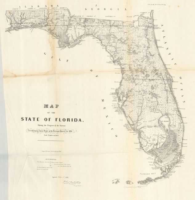
The first was published in 1856 by the General Land Office for their annual report. This early state survey map is drawn on a scale of 12 miles to the inch. It shows the topography, vegetation, towns, cities, forts, rivers, lakes, swamps and many early trails and roads. The map extends to show the keys and to Dry Tortugas Island and Ft. Jefferson. It locates Ft. Lauderdale, Boca Rabones, Key Biscayne and much, much more. It is signed in the plate by John Westcott, Surveyor General. This large map (22.5 x 25") was lithographed by Wagner & McGuigan's of Philadelphia in 1856. Uncolored.
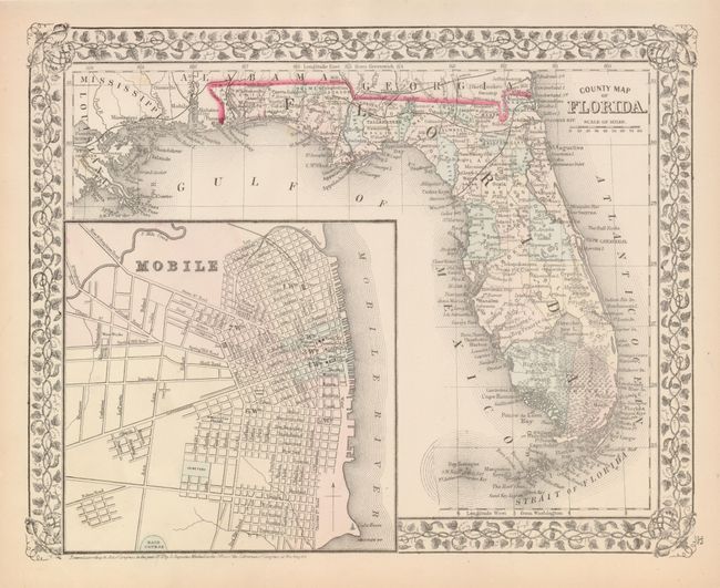
The second map was published by S. A. Mitchell in 1872. (13.4 x 10.6") This hand colored map features Mitchell's lovely grapevine border and a large and detailed inset plan of Mobile. Good detail throughout shows Florida with approximately thirty-seven counties. The railroads transverse the northern portion, extending only as far south as the Crystal River region, here named Atsena Otie. The Everglades and Big Cypress Swamp cover the entire southern portion. Miami is named.
References:
Condition:
The first has a crisp impression, folding as issued with full margins. It has a little water stain along two folds at upper left (B+). The second is very good (A).