Subject: Delaware
Period: 1802 (circa)
Publication: The General Atlas for Carey's Edition of Guthrie's Geography Improved
Color: Hand Color
Size:
9 x 16.3 inches
22.9 x 41.4 cm
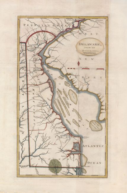
Mathew Carey was a seminal figure in early American publishing; establishing the first publishing firm to specialize in cartography and issuing the first atlas devoted exclusively to American maps. He set up an elaborate cottage system of craftsmen for compiling, engraving, printing, and coloring maps. This practice was emulated by later American cartographic publishers such as John Melish and Henry S. Tanner. The American Atlas concept was also adopted by other publishers in both the United States and Europe.
This early map of Delaware presents its three counties with details of the streams, rivers, principal towns and roads. It also shows the location of a forge and furnace in Sussex County. The map extends north to Philadelphia with sparse detail of the surrounding countryside. This is the second state with the addition of the page number 34 in the upper right corner of the plate. Engraved by W. Barker.
References: Wheat & Brun #483.
Condition: B+
A nice impression with wide original margins. There is some minor irregular toning, still a nice example.