Subject: San Francisco, California
Period: 1853 (dated)
Publication:
Color: Hand Color
Size:
18 x 26 inches
45.7 x 66 cm
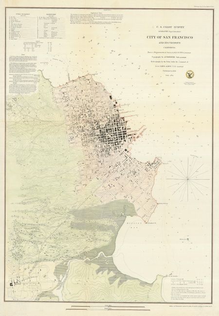
This large plan illustrates early San Francisco. It covers the region from North Point to Mission de Delores and to Point San Quentin. Streets are clearly laid out and named with detail down to individual buildings. Contour lines at 20 ft. intervals show elevation. Extant buildings are shown in black along the streets in both San Francisco and Mission de Dolores, which are connected by the Plank Road. Numbers keyed to an inset indicate sixteen public buildings and fifteen reservoirs.
References:
Condition: B+
A handsome example with later color and paper added to extend the lower right binding side. The map has been flattened and a fold separation is repaired on the verso with a near invisible bit of loss on Montgomery St.