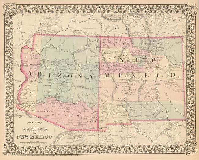
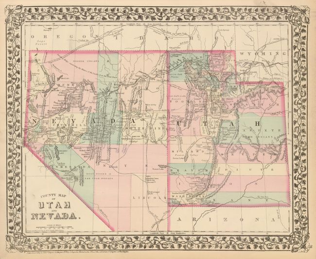
Subject: United States - Southwestern
Period: 1876 (dated)
Publication: New General Atlas
Color: Hand Color
Size:
14.3 x 11.5 inches
36.3 x 29.2 cm
Very attractive map with early county configurations, including the short-lived Pahute County in northwestern Arizona, one of the only maps to show this 'county.' The county was a political artifact resulting from Arizona's loss of its northwestern corner to Nevada. The map shows the first four counties of Arizona: Mohave, Yuma, Yavapai, and Pima. New Mexico has its "strip" counties. The maps shows numerous Indian tribes and villages, military forts and outposts, the Spanish Trail, copper and gold mines, and the tracks of many explorers. The County Map of Utah and Nevada is on verso. Handsome pastel color and a decorative grapevine border decorate.
References:
Condition: A
Good impression with fine original hand coloring. Minor soiling in margins only.