Subject: United States - Southwestern
Period: 1855 (dated)
Publication: General Atlas
Color: Hand Color
Size:
14.8 x 11.8 inches
37.6 x 30 cm
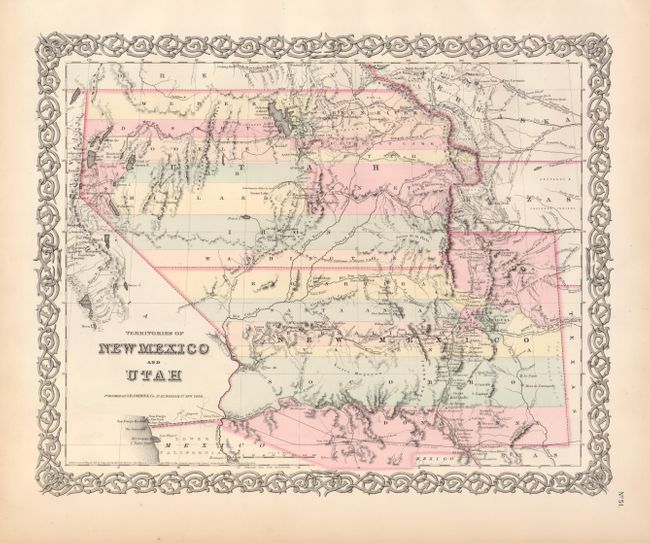
This is the second state of this interesting map, depicting the largest extents of Utah and New Mexico Territories. Utah Territory encompasses all of today's Nevada and extends west to the Continental Divide into present-day northern Colorado. Fillmore City is shown at the capital of Utah. New Mexico Territory includes part of southern Colorado and stretches west to include Arizona and the southern tip of present-day Nevada. The map locates Fremont's routes, the proposed routes for the Pacific Railroad, the Spanish Trail, and much more. A fine example of a very desirable map that Wheat found important enough to use as the frontispiece to Volume 4 of his Mapping the Trans-Mississippi West. Surrounded with Colton's trademark border.
References: Brown (Portolan, Spr. 2005) pp. 48; Wheat (TMW) #832 (frontis); Phillips & LeGear #816, 6116, 6125.
Condition: A+
Excellent condition with wide, clean margins and original hand color.