Catalog Archive
Auction 123, Lot 207

"Geographically Correct County Map Showing the Lines of the Cotton Belt Route and Connections", Railroad Companies, (Various)

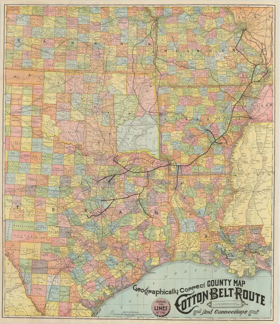
Subject: Texas, Arkansas, Missouri, Louisana, Oklahoma

Period: 1902 (dated)

Publication:

Color: Printed Color

Size:
29 x 34 inches
73.7 x 86.4 cm
Download High Resolution Image
(or just click on image to launch the Zoom viewer)

Large, colorful marketing map of Kansas, Missouri, Arkansas, Louisiana, Oklahoma and east Texas showing the Cotton Belt route from Cairo, Kentucky to Ft. Worth and Gatesville, Texas. The map shows roads, forts, cities, counties, watershed and Indian Reservations. Each Arkansas county has descriptive text and associated photographs on verso. Self folds into brightly printed red paper covers.

References:

Condition: A

A few, short fold separations repaired with archival tape on verso.

Estimate: $120 - $180

Sold for: $190

Closed on 2/20/2008

Archived