Subject: Southcentral United States, Arkansas
Period: 1825 (published)
Publication: Atlas Geographique, Statistique, Historique et Chronologique…
Color: Hand Color
Size:
14.3 x 14 inches
36.3 x 35.6 cm
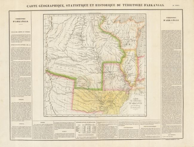
Reflecting Major Stephen H. Long's exploratory expeditions, this is an important map of the early western territories, focusing on the large Arkansas Territory, and depicting an early western border in Missouri. The map extends to the Rocky Mountains, and the plains are labeled Grand Desert. Numerous Indian villages are shown based on information gained from the Lewis and Clark expedition, and other important exploration routes are shown. The map shows Arkansas Territory extending to include present-day Oklahoma. The western portions of the map are identical to Long's map of 1823, also published by Carey & Lea. French text surrounds the map on three sides of the large folio sheet (24 x 17.8"). The map was originally engraved by Young & Delleker in 1822, and published by Carey and Lea. This is the French version.
References: Phillips (A) 1176-39; cf Wheat (TMW) 348.
Condition: B+
Delicate original color on a sheet with some faint irregular toning.