Subject: Central United States
Period: 1812 (circa)
Publication:
Color: Hand Color
Size:
9.6 x 7.6 inches
24.4 x 19.3 cm
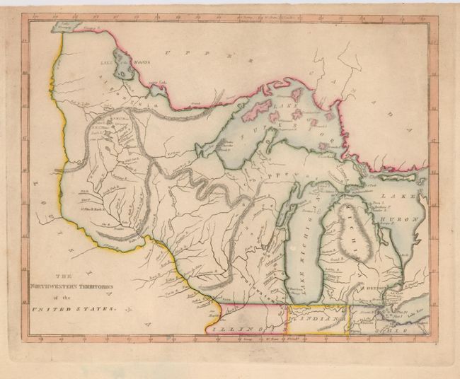
A scarce and great map that covers the region from Michigan through Lake of the Woods and Lake Winnipeg. The Great Lakes are slightly distorted and include the assumed islands in Lake Superior including one named Phillipeaux I. The map names Michigan, Illinois, Indiana, Ohio, and the settlements of Detroit, Sandwich, Miami B., F. St. Claire, F. Dearborne, Chicago and more. Illinois' northern border is shown even with the top of Indiana at 42°, which places Chicago in the Northwestern Territory. Spurious mountain ranges are shown snaking across the territory and are engraved in hachure.
References:
Condition: A
Narrow top margin, but adequate for framing. Very good impression with attractive color. Some minor soil in blank margins.