Catalog Archive
Auction 123, Lot 198

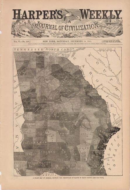
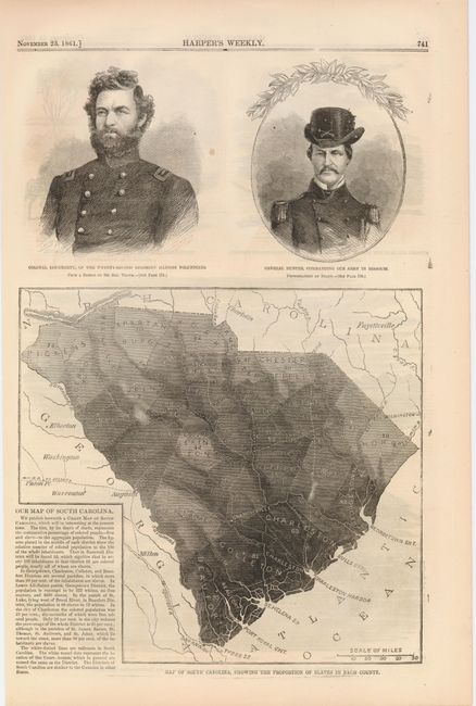
"[Lot of 2] A Chart of Georgia, Showing the Percentage of Slaves in Each County [with] Map of South Carolina, Showing the Proportion of Slaves in Each County", Harper's Weekly

Subject: United States - Southeast

Period: 1861 (dated)

Publication:

Color: Black & White

Size:
10.5 x 16 inches
26.7 x 40.6 cm
Download High Resolution Image
(or just click on image to launch the Zoom viewer)

This interesting pair of maps show the percentage of slaves (indicated by shading) in each county of Georgia and South Carolina. These range from 1% inland, to 92% along the coast. The Georgia map is on a full sheet below the Harper's Weekly masthead; the South Carolina map shares a page with portraits of Col. Dougherty and Gen. Hunter. Dimensions given are for the page.

References:

Condition: A

Pleasant age toning, a spot between the portraits, not affecting the image.

Estimate: $150 - $200

Sold for: $110

Closed on 2/20/2008

Archived