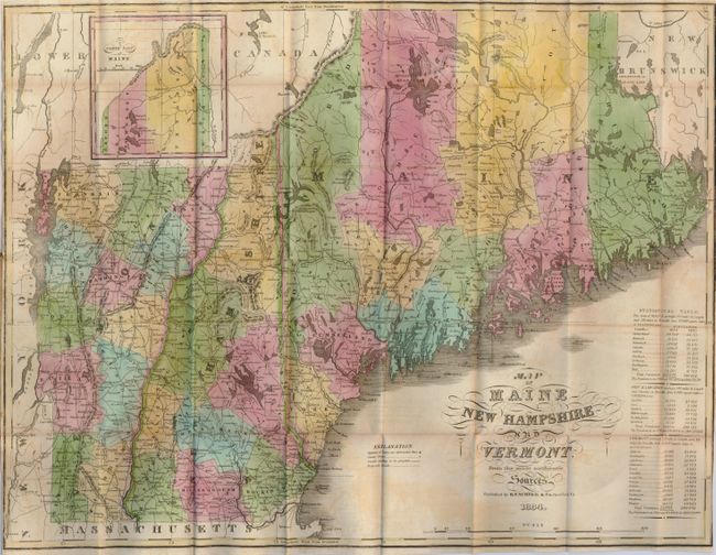
Subject: New England
Period: 1834 (dated)
Publication:
Color: Hand Color
Size:
19 x 15 inches
48.3 x 38.1 cm
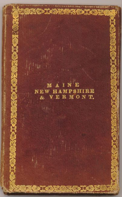
This scarce pocket map folds into its original gilt-stamped and decorated red morocco covers. Beautifully hand colored, the map has an extensive Statistical Table at lower right that compares county populations between 1820 and 1830. At upper left an inset details the "North Part of Maine." The extensive road network is well shown. The legend also locates canals and more. The inside cover has a paper label that lists population of principal towns. A very nice example of this early pocket map.
References: Cobb, D.A. (NH) #120.
Condition: B+
Very nice example with crisp impression and fine original coloring. A little offsetting visible in blank areas and a couple of small splits at fold intersections. The boards are a little rubbed, but gilt is good. Spine with a small portion missing at bottom.