Subject: Colonial New England
Period: 1777 (published)
Publication: Scot's Magazine
Color: Black & White
Size:
8 x 11.5 inches
20.3 x 29.2 cm
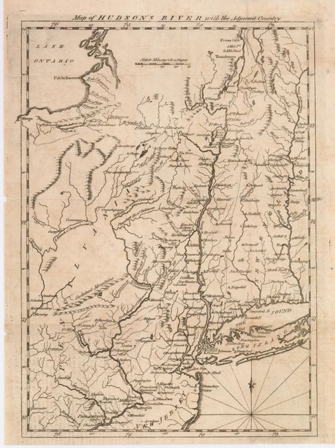
Great little map from this British periodical was designed to familiarize the magazine's readers with the location of the hostilities in the "American War." This map illustrates the region of the Hudson and Delaware Rivers, and the area of the marches of the armies under the Generals Howe, Clinton and Burgoyne. It covers New York and New England as far east as the Connecticut River, south to include Philadelphia, and north to encompass Crown Point and Ticonderoga. Rhumblines and fleur-de-lys in the sea.
References: Jolly-SCOT #46; Phillips [M] p.323.
Condition: B
Crisp impression on hand laid paper with small water mark. Some light foxing or toning and two tiny fold intersection holes visible when held to the light.