Subject: Eastern United States
Period: 1790 (circa)
Publication:
Color: Hand Color
Size:
10.5 x 8.6 inches
26.7 x 21.8 cm
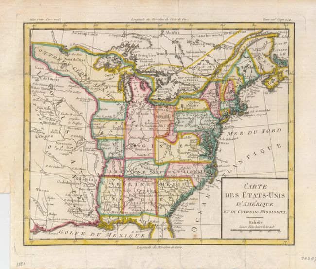
This is a fascinating map of the infant United States filled with details of early settlement, forts, and Indian villages as far west as present day Kansas. There are numerous odd boundaries delineated with engraved dotted lines that have been followed by the colorist. The most notable feature of the map is Frankland in the middle section of the region labeled Caroline Septentrionlale. In 1785, settlers in western North Carolina and what would become eastern Tennessee organized a state government to be named in honor of Benjamin Franklin. Congress turned down their appeal but the state maintained a legislature and governor until 1788. This ephemeral state appears on only a small number of maps. Also of interest is an early designation of Indiana, shown in the region that would become West Virginia. This land was a major contention between the private Indiana Land Company and the State of Virginia in the latter part of the 18th century. The argument over ownership of the property resulted in the Eleventh Amendment to the U.S. Constitution and the Indiana Land Company lost its claim to the land.
References: Baynton-Williams (TMC-72) #3.
Condition: B+
A nice example with folds as issued and a couple minor spots of foxing.