Catalog Archive
Auction 123, Lot 159

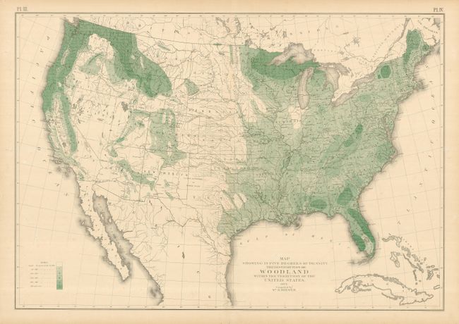
"Map Showing in Five Degrees of Density the Distribution of Woodland Within the Territory of the United States", General Land Office

Subject: United States

Period: 1873 (dated)

Publication: Report of the Surveyor General

Color: Printed Color

Size:
29 x 20 inches
73.7 x 50.8 cm
Download High Resolution Image
(or just click on image to launch the Zoom viewer)

An interesting thematic map showing the density of forests across the United States, compiled by William H. Brewer. The forests are dense in the Pacific Northwest, northern Michigan and Wisconsin, and a few scattered spots on the East Coast, including northern Maine and parts of Florida. The Great Plains and most of the Southwest are shown with under 40 acres of forests per square mile, while the densest areas have at least 560 acres of forest per square mile.

References:

Condition: B+

Nice lithographed color. Upper margin with two repaired tears just past the border. A few short tears in the blank margins that don't affect the map.

Estimate: $160 - $200

Sold for: $130

Closed on 2/20/2008

Archived